MTA C&D

PROJECT OWNER
LOCATION
CLIENT(s)
SERVICES PROVIDED
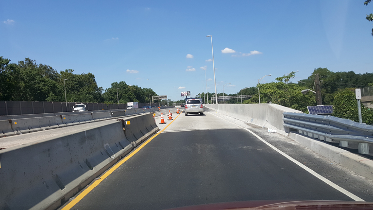
As part of NJTA’s $286 million toll-funded Interchange 14A improvement project, Interchange 14A connected Route 440 and the local Bayonne Street network with the NJ Turnpike Hudson County Extension (HCE). It also provided access to Jersey City to the north and Staten Island to the south via the Bayonne Bridge. In 2007, it had been identified as the highest priority studied interchange for improvements based on traffic volumes and accident rates. On a typical weekday, approximately 50,000 vehicles, including over 6,000 trucks, used Interchange 14A to access the HCE. Due to local redevelopment in Bayonne and Jersey City, the interchange experienced significant growth, resulting in congested conditions at the interchange itself, on Route 440, and on local roads. Additionally, the area was anticipated to see future growth based on planned harbor and port terminal projects. The main goal of the project was to relieve congestion within the project limits and the surrounding local roadway network. The existing toll plaza was improved as part of the project scope to prepare for the future implementation of All Electronic Open Road Tolling.
SJH was responsible for the design of the Ramp TP-Peninsula over Pulaski Street Bridge and MSE Retaining Wall No. 18 between Connector Bridge TE and Ramp TP-Peninsula. The new single-span ramp structure featured horizontally curved welded steel plate girders and a single-course HPC deck. Stub abutments were supported on a single row of 24” diameter concrete-filled steel pipe piles with wrap-around MSE walls. The design accounted for the required deck width to allow for future two-stage redecking and future bearing replacement without the need for temporary shoring. MSE Wall No. 18 measured 516 feet in length and had over 8,100 square feet of exposed area. Due to existing subsurface conditions and the substantial height of the proposed embankment fill, ground improvement in the form of a concrete column and load transfer platform was installed prior to embankment placement. Additionally, since the area fell within the flood zone limits, AASHTO #57 stone was placed up to the 500-year flood level to enable rapid discharge of floodwater without causing damage to the MSE wall and the retained approach roadway.
RELATED PROJECTS